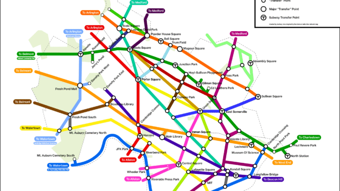
CBS volunteer Z(achary) Yaro has created a landway map of Cambridge. Using ideas from the classic T subway map, light rail maps, and the Paris réseau vélopolitain, The Camberville Landway map envisions a network of separated paths and lanes across Cambridge and Somerville and identifies the connections we need to build so people of all ages can get around on bikes, scooters, and other mobility devices. Different versions of the map show the network as it is now and how the completed plans will create paths to travel around the city more easily and safely.
To learn more visit the full story on Boston Cyclists Union Website: https://bostoncyclistsunion.org/introducing-the-landway
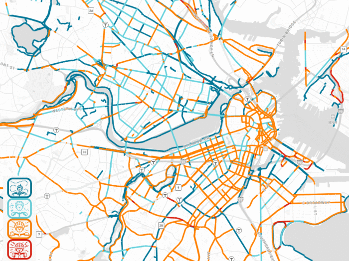
Another new tool to map cycling networks is also featured on the BCU site created by BCU Labs is the Bike Stress Map. This is a tool that helps viewers to better understand how people riding bikes or other personal mobility devices likely experience stress caused by automobile traffic while traveling through the city. https://bostoncyclistsunion.org/bcu-labs-launches-bike-stress-map.